Let’s get into the details of when our guide, Cesare from , took us on some iconic climbs in the Fassa Valley while we were trying to dip our toes into alpine trad climbing in the Dolomites.
This post covers day 1 of our three-day adventure in Pozza di Fassa — climbing the Via Piccola Micheluzzi, a classic route dating back to 1928.
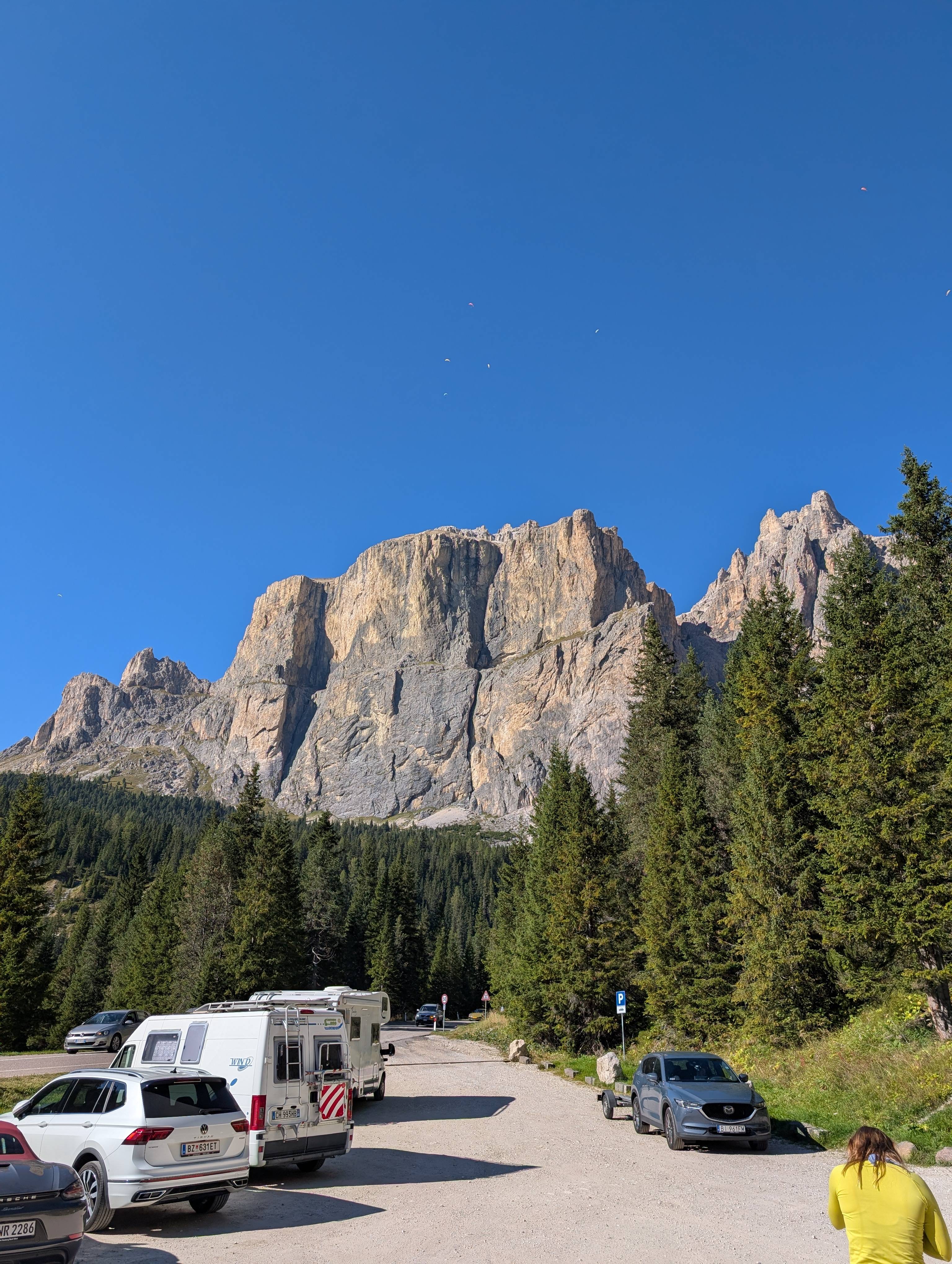
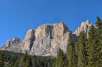
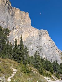
Since we planned to climb on Friday, Saturday, and Sunday, we arrived in Pozza di Fassa on Thursday afternoon. Because we already knew the tentative plan and had a free afternoon, we decided to go check out the area. We took the road from Canazei up to . After about 9 km and many hairpin turns, the south face of Piz Ciavazes towers over the road on the right-hand side.
Unlike some of the other, more pointy peaks in this area, Piz Ciavazes is rather stocky — like two boxes stacked on top of each other, with a little grass patch in between. On that grass patch, there’s a narrow trail cutting across the face from left to right. It’s called the Gamsband. As Cesare explained to us, Gams comes from German and means chamois, which is a mountain goat commonly found in the Alps. Band simply means “ledge.” So, there’s a mountain goat trail in the middle of the rock, and that’s also where most of the climbing routes, including the Piccola Micheluzzi, end.
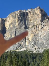
As we drive just under the cliff face, I point to the Gamsband and tell Daysi, “I think the grass patch over there is where we could potentially climb tomorrow.” “Very cool,” she responds, unimpressed. It turns out we were both looking at very different grass patches. I was looking at one about 300 m above us, and Daysi was staring at some random patch of grass basically next to the road. Classic. (She’ll admit her eyesight isn’t great.)
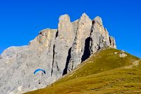
We continued all the way to the top of the Sella Pass, had a little birthday picnic, and watched the paragliders taking off from the meadows up there. We actually gave a ride to one of them on our way up since apparently the ski lift they usually take was under construction. He told us that that day was one of the best days of the season for paragliding and that’s why there were hundreds of them circling in the sky.
After that, we returned to Pozza and had dinner at . While we were eating dinner, I got a message from Cesare saying that he’d meet us at our hotel the following morning at 7:45. Well, that leaves us with 15 minutes for breakfast — not ideal, but enough for a quick coffee and a croissant.
Approach to the climb
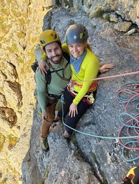
As agreed, we met on Friday morning in front of our hotel in Pozza di Fassa. Cesare greeted us with a smile on his face. He came across as a warm and friendly person, and we could tell he was genuinely excited to spend a day in the mountains. We immediately had a good feeling about this.
That day, we took our own car (we wanted to do some more exploring after the climb) and followed him up the now familiar road to the Sella Pass. Cesare made sure he didn’t lose us, but I could tell he knew these roads like the back of his hand. He drove swiftly, confidently, and with purpose. That was one of the reasons it’s probably better to ride in the guide’s car if they offer it, we just didn’t know it yet.
Anyway, we were in Canazei in no time. We took the second exit at the roundabout, and up we went — through the endless hairpins into the mountains.
There are lots of little pullouts on both sides of the road, especially after , so we just try to pick one closest to the base of our climb.
Two things are worth mentioning:
- The walk-off from the climbing routes via the Gamsband is toward the west, parallel to the uphill direction of the road. If you can’t find a spot right at the base of your climb, continue driving up and find one higher, then walk downhill to the base of your climb. Your return hike will be shorter too. It’s definitely nicer than the other way around.
- Even though there are plenty of spaces, this area gets busy. Especially in the summer and on nice weekends. Many climbers and paragliders car camp on the side of the road, so finding parking might be tricky, especially if you arrive later in the morning.
Two sides of the Sella Pass
When you take the road up from Canazei and cross the Sella Pass, you’re also crossing from the Trentino region into South Tyrol. South Tyrol is predominantly German-influenced, and as we all know, the Germans like their rules.
A couple of years back, apparently — as Cesare explained to us — South Tyrol made a big push against people car camping and parking on the side of the road. As a result, there are now only a bunch of gated, paid parking lots on their side. And all the riff-raff, naturally, ended up on the more relaxed Trentino side.
So if you’re planning to car camp at the Sella Pass, stay on the true Italian side — the other side is somewhat off-limits.
We were lucky and found parking for both cars right at the . We quickly sorted through the gear we’d need, but since we were only going to be following and Cesare already had the ropes, it wasn’t a lot. We locked the cars and headed out.
The approach was straightforward and only took about 10 minutes. Although we couldn’t find the trail on any of the popular mapping sites, there were plenty of small paths through the scree field leading straight to the . Below is the GPX of the route we took.
Via Piccola Micheluzzi Approach GPX
<?xml version="1.0" ?>
<gpx xmlns="http://www.topografix.com/GPX/1/1" creator="SpaghettiAndSummits" version="1.1" xmlns:xsi="http://www.w3.org/2001/XMLSchema-instance" xsi:schemaLocation="http://www.topografix.com/GPX/1/1 http://www.topografix.com/GPX/1/1/gpx.xsd">
<rte>
<name>Piccola Micheluzzi Approach</name>
<desc>
</desc>
<extensions>
<line xmlns="http://www.topografix.com/GPX/gpx_style/0/2">
<color>5726C2</color>
</line>
</extensions>
<rtept lat="46.506454" lon="11.783863">
<ele>2082.0</ele>
<time>2025-10-27T11:18:02Z</time>
</rtept>
<rtept lat="46.506592" lon="11.783833">
<ele>2082.60009765625</ele>
<time>2025-10-27T11:18:02Z</time>
</rtept>
<rtept lat="46.506819" lon="11.783685">
<ele>2082.800048828125</ele>
<time>2025-10-27T11:18:02Z</time>
</rtept>
<rtept lat="46.506855" lon="11.783582">
<ele>2081.199951171875</ele>
<time>2025-10-27T11:18:02Z</time>
</rtept>
<rtept lat="46.507051" lon="11.783413">
<ele>2073.199951171875</ele>
<time>2025-10-27T11:18:02Z</time>
</rtept>
<rtept lat="46.507297" lon="11.783423">
<ele>2060.39990234375</ele>
<time>2025-10-27T11:18:02Z</time>
</rtept>
<rtept lat="46.507498" lon="11.783316">
<ele>2054.800048828125</ele>
<time>2025-10-27T11:18:02Z</time>
</rtept>
<rtept lat="46.507653" lon="11.783394">
<ele>2055.199951171875</ele>
<time>2025-10-27T11:18:02Z</time>
</rtept>
<rtept lat="46.507661" lon="11.783398">
<ele>2055.199951171875</ele>
<time>2025-10-27T11:18:02Z</time>
</rtept>
<rtept lat="46.507661" lon="11.783398">
<ele>2055.199951171875</ele>
<time>2025-10-27T11:18:02Z</time>
</rtept>
<rtept lat="46.507678" lon="11.783365">
<ele>2058.60009765625</ele>
<time>2025-10-27T11:18:02Z</time>
</rtept>
<rtept lat="46.507751" lon="11.783742">
<ele>2055.800048828125</ele>
<time>2025-10-27T11:18:02Z</time>
</rtept>
<rtept lat="46.507825" lon="11.78412">
<ele>2063.0</ele>
<time>2025-10-27T11:18:02Z</time>
</rtept>
<rtept lat="46.507898" lon="11.784497">
<ele>2070.0</ele>
<time>2025-10-27T11:18:02Z</time>
</rtept>
<rtept lat="46.507971" lon="11.784874">
<ele>2065.800048828125</ele>
<time>2025-10-27T11:18:02Z</time>
</rtept>
<rtept lat="46.508044" lon="11.785251">
<ele>2064.0</ele>
<time>2025-10-27T11:18:02Z</time>
</rtept>
<rtept lat="46.508118" lon="11.785629">
<ele>2058.39990234375</ele>
<time>2025-10-27T11:18:02Z</time>
</rtept>
<rtept lat="46.508191" lon="11.786006">
<ele>2065.800048828125</ele>
<time>2025-10-27T11:18:02Z</time>
</rtept>
<rtept lat="46.508237" lon="11.786244">
<ele>2088.0</ele>
<time>2025-10-27T11:18:02Z</time>
</rtept>
</rte>
</gpx>
Climbing
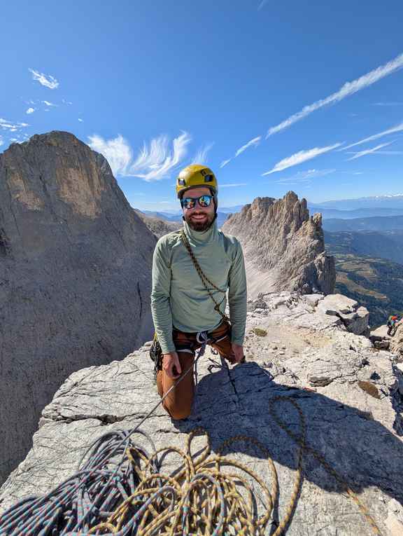
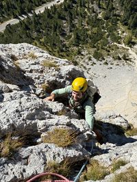
As far as we could tell, we were the first ones on the route that day. Since there are some loose rocks up there, the first thing we did was put on our helmets. (Note: The guides will not let you climb without a helmet.)
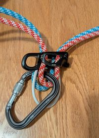
As I mentioned, Cesare was leading the route and placing gear. We were only following him. To make things more efficient while climbing with three people, and as is common in alpine climbing, we used half ropes. It’s worth mentioning that if you’re booking a guided climb with a party of three, you need to be able to belay your guide using an ATC (or similar device) with two strands of rope.
Note on Half Ropes
I was familiar with half ropes before this trip, but I’d never actually climbed on them. I always sort of discounted them as one of those things that, although it exists, I’d never use. Well, that’s changed now.
Here are a few observations about climbing on half ropes:
- If you’re leading, you have to lead on both at the same time — a single strand isn’t rated for lead falls. If you’re following, you can use just a single strand, which is perfect for a party of three. Whoever leads is tied into both strands, and the followers each take one. Efficient.
- The ropes are usually smaller in diameter, which means lighter. So instead of one bulky rope, you have two lighter ones that you can divide among the climbing party on the approach.
- Dealing with two ropes at the belay stations adds a bit more complexity and can get messy, but overall, it’s not bad.
- And finally, when it comes to rappelling — with a single rope, you have to fold it in half so you can rappel on two strands. That means you can only use half the rope’s length. Effectively, a 60 m rope will only get you 30 m lower. But with half ropes, you already have two strands! You just tie them together at one end and voilà — you can rap the full 60 meters. That’s pretty neat.
Once we were all geared up, Cesare quickly but diligently walked us through the logistics of the climb. Nothing came as a surprise to us, so we set off shortly after. Since this is a very well-known route and there are countless descriptions and topos online (for example here or here), I won’t go into detail pitch by pitch — I’ll rather focus on the overall experience.
Generally, the first few pitches are very easy, sometimes feeling more like scrambling. The very first pitch has multiple variations — some of them are more suitable if it has been raining recently, but all of them should take you to the same belay station.
Overall, it was exactly what we were hoping for: easy climbing to get us off the ground and observe Cesare in his natural habitat. There’s a good amount of fixed protection on the route, including pitons and pre-tied slings, but plenty of space to place your own gear and make it less runout. Cesare was very diligent in explaining everything he was doing as he led the way up.
We continued climbing, and with each pitch, we grew more comfortable and started really enjoying the climb.
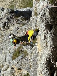
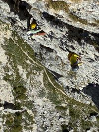
Pitch 5 is where things get a little more difficult — at least mentally. The wall gets more vertical, the climbing more exposed, and some sections of the rock are quite polished. But overall, there are still plenty of very good holds. The pitch ends in a relatively large niche, and the belay station has kind of a cool, nest-like vibe. I liked it there.
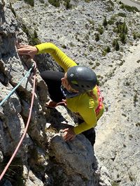
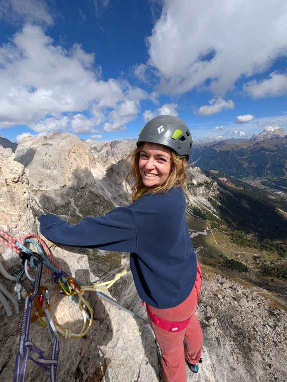
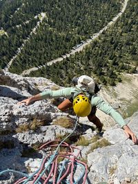
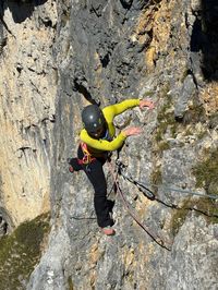
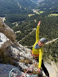
The next two pitches are the most fun on the route. We leave the nest, stepping out onto vertical and very exposed rock. You’re really out there — it feels airy. I was scared, but I liked it. We climbed up to the next belay station and started the last pitch. The crux of that pitch is a slightly overhanging chimney. An opportunity for some cool stemming moves. The chimney spits us out into a small basin at the edge of the Gamsband. And that’s it — three and a half hours later, at 11:53, we’d survived (and enjoyed) our first alpine trad climb!
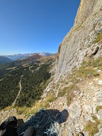
We topped out . Technically, I think you continue “climbing” for one more very easy pitch to the left, but you can also reach the trail by hiking slightly up and to the right through the grass patches — and that’s what we did.
Descend from the climb
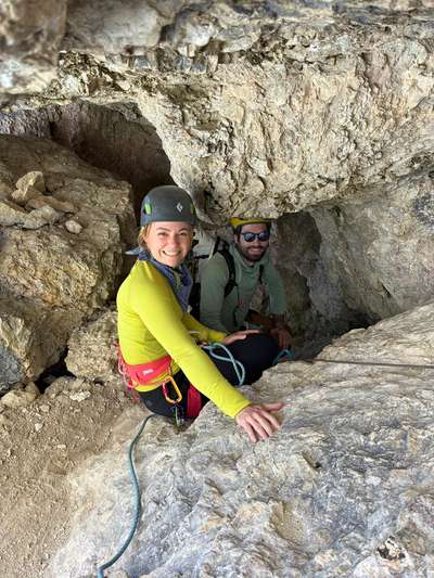
We stayed roped in, keeping about 7 m between each other so that if one of us slipped, the other two could brace and hopefully arrest the fall. For the most part, the descent trail is pretty nice and not very exposed. There are just a few spicier sections, but those have a steel cable you can clip into. At one point, you crawl or slide through a small tunnel.
After that, you continue heading west until you reach the first rappel. It’s pretty obvious, and there are rap rings in good condition on the rock. You could probably downclimb it, but why take the risk? Shortly after the first rappel, the trail joins the descent path from the Sella Towers, and not too long after, you arrive at an obvious fork in the trail. The left path goes through an easy scramble down, while the right path has another quick and clean rappel.
After that, you continue downhill toward the west until you reach another fork. If you go right and uphill, you’ll end up at the Sella Pass. If you go left and downhill, you’ll head back to the parking lot where we left our cars. We took the left trail and reached the parking lot at 2:08.
Via Piccola Micheluzzi Descend GPX
<?xml version="1.0" ?>
<gpx xmlns="http://www.topografix.com/GPX/1/1" creator="SpaghettiAndSummits" version="1.1" xmlns:xsi="http://www.w3.org/2001/XMLSchema-instance" xsi:schemaLocation="http://www.topografix.com/GPX/1/1 http://www.topografix.com/GPX/1/1/gpx.xsd">
<rte>
<name>Via Piccola Micheluzzi Walk Off</name>
<desc>
</desc>
<extensions>
<line xmlns="http://www.topografix.com/GPX/gpx_style/0/2">
<color>00A478</color>
</line>
</extensions>
<rtept lat="46.508798" lon="11.786089">
<ele>2320.199951171875</ele>
<time>2025-10-27T13:38:41Z</time>
</rtept>
<rtept lat="46.508932" lon="11.78643">
<ele>2340.0</ele>
<time>2025-10-27T13:38:41Z</time>
</rtept>
<rtept lat="46.508935" lon="11.786438">
<ele>2340.0</ele>
<time>2025-10-27T13:38:41Z</time>
</rtept>
<rtept lat="46.508935" lon="11.786438">
<ele>2340.0</ele>
<time>2025-10-27T13:38:41Z</time>
</rtept>
<rtept lat="46.508972" lon="11.78605">
<ele>2372.0</ele>
<time>2025-10-27T13:38:41Z</time>
</rtept>
<rtept lat="46.50901" lon="11.785662">
<ele>2344.800048828125</ele>
<time>2025-10-27T13:38:41Z</time>
</rtept>
<rtept lat="46.509035" lon="11.785398">
<ele>2305.199951171875</ele>
<time>2025-10-27T13:38:41Z</time>
</rtept>
<rtept lat="46.509035" lon="11.785398">
<ele>2305.199951171875</ele>
<time>2025-10-27T13:38:41Z</time>
</rtept>
<rtept lat="46.509037" lon="11.785006">
<ele>2272.60009765625</ele>
<time>2025-10-27T13:38:41Z</time>
</rtept>
<rtept lat="46.509039" lon="11.784614">
<ele>2256.800048828125</ele>
<time>2025-10-27T13:38:41Z</time>
</rtept>
<rtept lat="46.509039" lon="11.784598">
<ele>2256.800048828125</ele>
<time>2025-10-27T13:38:41Z</time>
</rtept>
<rtept lat="46.509039" lon="11.784598">
<ele>2256.800048828125</ele>
<time>2025-10-27T13:38:41Z</time>
</rtept>
<rtept lat="46.509113" lon="11.784489">
<ele>2263.39990234375</ele>
<time>2025-10-27T13:38:41Z</time>
</rtept>
<rtept lat="46.509113" lon="11.784489">
<ele>2263.39990234375</ele>
<time>2025-10-27T13:38:41Z</time>
</rtept>
<rtept lat="46.509063" lon="11.784391">
<ele>2254.800048828125</ele>
<time>2025-10-27T13:38:41Z</time>
</rtept>
<rtept lat="46.508968" lon="11.784138">
<ele>2245.39990234375</ele>
<time>2025-10-27T13:38:41Z</time>
</rtept>
<rtept lat="46.508982" lon="11.784068">
<ele>2244.800048828125</ele>
<time>2025-10-27T13:38:41Z</time>
</rtept>
<rtept lat="46.508974" lon="11.784044">
<ele>2244.800048828125</ele>
<time>2025-10-27T13:38:41Z</time>
</rtept>
<rtept lat="46.508943" lon="11.784029">
<ele>2237.39990234375</ele>
<time>2025-10-27T13:38:41Z</time>
</rtept>
<rtept lat="46.508917" lon="11.783981">
<ele>2237.39990234375</ele>
<time>2025-10-27T13:38:41Z</time>
</rtept>
<rtept lat="46.508799" lon="11.783762">
<ele>2224.800048828125</ele>
<time>2025-10-27T13:38:41Z</time>
</rtept>
<rtept lat="46.508755" lon="11.783589">
<ele>2219.0</ele>
<time>2025-10-27T13:38:41Z</time>
</rtept>
<rtept lat="46.508811" lon="11.783436">
<ele>2227.0</ele>
<time>2025-10-27T13:38:41Z</time>
</rtept>
<rtept lat="46.508812" lon="11.783412">
<ele>2227.0</ele>
<time>2025-10-27T13:38:41Z</time>
</rtept>
<rtept lat="46.508812" lon="11.783412">
<ele>2227.0</ele>
<time>2025-10-27T13:38:41Z</time>
</rtept>
<rtept lat="46.508835" lon="11.782658">
<ele>2229.60009765625</ele>
<time>2025-10-27T13:38:41Z</time>
</rtept>
<rtept lat="46.508846" lon="11.782575">
<ele>2229.60009765625</ele>
<time>2025-10-27T13:38:41Z</time>
</rtept>
<rtept lat="46.508882" lon="11.78248">
<ele>2235.800048828125</ele>
<time>2025-10-27T13:38:41Z</time>
</rtept>
<rtept lat="46.508943" lon="11.782407">
<ele>2241.60009765625</ele>
<time>2025-10-27T13:38:41Z</time>
</rtept>
<rtept lat="46.508989" lon="11.782318">
<ele>2247.0</ele>
<time>2025-10-27T13:38:41Z</time>
</rtept>
<rtept lat="46.509125" lon="11.782156">
<ele>2257.199951171875</ele>
<time>2025-10-27T13:38:41Z</time>
</rtept>
<rtept lat="46.509173" lon="11.782002">
<ele>2261.800048828125</ele>
<time>2025-10-27T13:38:41Z</time>
</rtept>
<rtept lat="46.509215" lon="11.781968">
<ele>2266.60009765625</ele>
<time>2025-10-27T13:38:41Z</time>
</rtept>
<rtept lat="46.509215" lon="11.781968">
<ele>2266.60009765625</ele>
<time>2025-10-27T13:38:41Z</time>
</rtept>
<rtept lat="46.509299" lon="11.781899">
<ele>2271.60009765625</ele>
<time>2025-10-27T13:38:41Z</time>
</rtept>
<rtept lat="46.50934" lon="11.781714">
<ele>2276.199951171875</ele>
<time>2025-10-27T13:38:41Z</time>
</rtept>
<rtept lat="46.509367" lon="11.78169">
<ele>2276.199951171875</ele>
<time>2025-10-27T13:38:41Z</time>
</rtept>
<rtept lat="46.509365" lon="11.781641">
<ele>2276.199951171875</ele>
<time>2025-10-27T13:38:41Z</time>
</rtept>
<rtept lat="46.50938" lon="11.781613">
<ele>2276.0</ele>
<time>2025-10-27T13:38:41Z</time>
</rtept>
<rtept lat="46.509466" lon="11.781541">
<ele>2286.199951171875</ele>
<time>2025-10-27T13:38:41Z</time>
</rtept>
<rtept lat="46.509497" lon="11.781526">
<ele>2286.199951171875</ele>
<time>2025-10-27T13:38:41Z</time>
</rtept>
<rtept lat="46.509534" lon="11.781419">
<ele>2291.199951171875</ele>
<time>2025-10-27T13:38:41Z</time>
</rtept>
<rtept lat="46.509519" lon="11.780754">
<ele>2289.39990234375</ele>
<time>2025-10-27T13:38:41Z</time>
</rtept>
<rtept lat="46.509439" lon="11.780779">
<ele>2279.39990234375</ele>
<time>2025-10-27T13:38:41Z</time>
</rtept>
<rtept lat="46.509401" lon="11.780829">
<ele>2279.39990234375</ele>
<time>2025-10-27T13:38:41Z</time>
</rtept>
<rtept lat="46.509326" lon="11.780848">
<ele>2274.39990234375</ele>
<time>2025-10-27T13:38:41Z</time>
</rtept>
<rtept lat="46.509266" lon="11.780873">
<ele>2269.39990234375</ele>
<time>2025-10-27T13:38:41Z</time>
</rtept>
<rtept lat="46.50919" lon="11.780855">
<ele>2259.60009765625</ele>
<time>2025-10-27T13:38:41Z</time>
</rtept>
<rtept lat="46.509111" lon="11.780923">
<ele>2254.0</ele>
<time>2025-10-27T13:38:41Z</time>
</rtept>
<rtept lat="46.509079" lon="11.780925">
<ele>2248.39990234375</ele>
<time>2025-10-27T13:38:41Z</time>
</rtept>
<rtept lat="46.508988" lon="11.780809">
<ele>2242.39990234375</ele>
<time>2025-10-27T13:38:41Z</time>
</rtept>
<rtept lat="46.50894" lon="11.780786">
<ele>2236.199951171875</ele>
<time>2025-10-27T13:38:41Z</time>
</rtept>
<rtept lat="46.508896" lon="11.7808">
<ele>2229.800048828125</ele>
<time>2025-10-27T13:38:41Z</time>
</rtept>
<rtept lat="46.508871" lon="11.780865">
<ele>2230.199951171875</ele>
<time>2025-10-27T13:38:41Z</time>
</rtept>
<rtept lat="46.508853" lon="11.780957">
<ele>2230.60009765625</ele>
<time>2025-10-27T13:38:41Z</time>
</rtept>
<rtept lat="46.508838" lon="11.781055">
<ele>2224.39990234375</ele>
<time>2025-10-27T13:38:41Z</time>
</rtept>
<rtept lat="46.508816" lon="11.78111">
<ele>2224.39990234375</ele>
<time>2025-10-27T13:38:41Z</time>
</rtept>
<rtept lat="46.50879" lon="11.781136">
<ele>2224.800048828125</ele>
<time>2025-10-27T13:38:41Z</time>
</rtept>
<rtept lat="46.50875" lon="11.781136">
<ele>2217.800048828125</ele>
<time>2025-10-27T13:38:41Z</time>
</rtept>
<rtept lat="46.508704" lon="11.781116">
<ele>2210.0</ele>
<time>2025-10-27T13:38:41Z</time>
</rtept>
<rtept lat="46.508691" lon="11.781067">
<ele>2210.0</ele>
<time>2025-10-27T13:38:41Z</time>
</rtept>
<rtept lat="46.508762" lon="11.780845">
<ele>2216.199951171875</ele>
<time>2025-10-27T13:38:41Z</time>
</rtept>
<rtept lat="46.508755" lon="11.780712">
<ele>2216.0</ele>
<time>2025-10-27T13:38:41Z</time>
</rtept>
<rtept lat="46.508829" lon="11.780493">
<ele>2222.60009765625</ele>
<time>2025-10-27T13:38:41Z</time>
</rtept>
<rtept lat="46.508829" lon="11.780493">
<ele>2222.60009765625</ele>
<time>2025-10-27T13:38:41Z</time>
</rtept>
<rtept lat="46.508843" lon="11.780453">
<ele>2222.60009765625</ele>
<time>2025-10-27T13:38:41Z</time>
</rtept>
<rtept lat="46.508837" lon="11.780359">
<ele>2222.800048828125</ele>
<time>2025-10-27T13:38:41Z</time>
</rtept>
<rtept lat="46.508951" lon="11.780157">
<ele>2236.800048828125</ele>
<time>2025-10-27T13:38:41Z</time>
</rtept>
<rtept lat="46.508963" lon="11.780035">
<ele>2236.199951171875</ele>
<time>2025-10-27T13:38:41Z</time>
</rtept>
<rtept lat="46.508989" lon="11.780051">
<ele>2242.199951171875</ele>
<time>2025-10-27T13:38:41Z</time>
</rtept>
<rtept lat="46.509027" lon="11.779972">
<ele>2247.60009765625</ele>
<time>2025-10-27T13:38:41Z</time>
</rtept>
<rtept lat="46.509104" lon="11.77997">
<ele>2253.199951171875</ele>
<time>2025-10-27T13:38:41Z</time>
</rtept>
<rtept lat="46.509193" lon="11.77991">
<ele>2258.39990234375</ele>
<time>2025-10-27T13:38:41Z</time>
</rtept>
<rtept lat="46.50925" lon="11.779743">
<ele>2263.60009765625</ele>
<time>2025-10-27T13:38:41Z</time>
</rtept>
<rtept lat="46.509294" lon="11.779701">
<ele>2268.39990234375</ele>
<time>2025-10-27T13:38:41Z</time>
</rtept>
<rtept lat="46.509345" lon="11.779703">
<ele>2273.0</ele>
<time>2025-10-27T13:38:41Z</time>
</rtept>
<rtept lat="46.509366" lon="11.779638">
<ele>2273.0</ele>
<time>2025-10-27T13:38:41Z</time>
</rtept>
<rtept lat="46.5094" lon="11.779594">
<ele>2277.800048828125</ele>
<time>2025-10-27T13:38:41Z</time>
</rtept>
<rtept lat="46.509395" lon="11.77952">
<ele>2277.800048828125</ele>
<time>2025-10-27T13:38:41Z</time>
</rtept>
<rtept lat="46.509419" lon="11.779455">
<ele>2277.800048828125</ele>
<time>2025-10-27T13:38:41Z</time>
</rtept>
<rtept lat="46.509409" lon="11.779394">
<ele>2277.800048828125</ele>
<time>2025-10-27T13:38:41Z</time>
</rtept>
<rtept lat="46.509428" lon="11.779302">
<ele>2278.0</ele>
<time>2025-10-27T13:38:41Z</time>
</rtept>
<rtept lat="46.509518" lon="11.779177">
<ele>2287.39990234375</ele>
<time>2025-10-27T13:38:41Z</time>
</rtept>
<rtept lat="46.509525" lon="11.779097">
<ele>2287.39990234375</ele>
<time>2025-10-27T13:38:41Z</time>
</rtept>
<rtept lat="46.509669" lon="11.779027">
<ele>2296.800048828125</ele>
<time>2025-10-27T13:38:41Z</time>
</rtept>
<rtept lat="46.509668" lon="11.778913">
<ele>2296.800048828125</ele>
<time>2025-10-27T13:38:41Z</time>
</rtept>
<rtept lat="46.509619" lon="11.778758">
<ele>2297.0</ele>
<time>2025-10-27T13:38:41Z</time>
</rtept>
<rtept lat="46.509616" lon="11.778498">
<ele>2293.199951171875</ele>
<time>2025-10-27T13:38:41Z</time>
</rtept>
<rtept lat="46.509582" lon="11.778412">
<ele>2293.39990234375</ele>
<time>2025-10-27T13:38:41Z</time>
</rtept>
<rtept lat="46.50959" lon="11.778329">
<ele>2293.39990234375</ele>
<time>2025-10-27T13:38:41Z</time>
</rtept>
<rtept lat="46.509578" lon="11.778281">
<ele>2293.60009765625</ele>
<time>2025-10-27T13:38:41Z</time>
</rtept>
<rtept lat="46.509631" lon="11.778111">
<ele>2298.199951171875</ele>
<time>2025-10-27T13:38:41Z</time>
</rtept>
<rtept lat="46.50959" lon="11.777862">
<ele>2295.199951171875</ele>
<time>2025-10-27T13:38:41Z</time>
</rtept>
<rtept lat="46.509534" lon="11.777731">
<ele>2292.60009765625</ele>
<time>2025-10-27T13:38:41Z</time>
</rtept>
<rtept lat="46.509482" lon="11.777642">
<ele>2289.60009765625</ele>
<time>2025-10-27T13:38:41Z</time>
</rtept>
<rtept lat="46.509371" lon="11.777621">
<ele>2283.0</ele>
<time>2025-10-27T13:38:41Z</time>
</rtept>
<rtept lat="46.509371" lon="11.777621">
<ele>2283.0</ele>
<time>2025-10-27T13:38:41Z</time>
</rtept>
<rtept lat="46.509256" lon="11.777474">
<ele>2278.800048828125</ele>
<time>2025-10-27T13:38:41Z</time>
</rtept>
<rtept lat="46.509256" lon="11.777474">
<ele>2278.800048828125</ele>
<time>2025-10-27T13:38:41Z</time>
</rtept>
<rtept lat="46.50927" lon="11.777471">
<ele>2281.800048828125</ele>
<time>2025-10-27T13:38:41Z</time>
</rtept>
<rtept lat="46.509123" lon="11.777468">
<ele>2273.0</ele>
<time>2025-10-27T13:38:41Z</time>
</rtept>
<rtept lat="46.509123" lon="11.777468">
<ele>2273.0</ele>
<time>2025-10-27T13:38:41Z</time>
</rtept>
<rtept lat="46.509149" lon="11.777509">
<ele>2276.0</ele>
<time>2025-10-27T13:38:41Z</time>
</rtept>
<rtept lat="46.508891" lon="11.777157">
<ele>2265.0</ele>
<time>2025-10-27T13:38:41Z</time>
</rtept>
<rtept lat="46.508645" lon="11.776728">
<ele>2260.39990234375</ele>
<time>2025-10-27T13:38:41Z</time>
</rtept>
<rtept lat="46.508218" lon="11.77587">
<ele>2241.60009765625</ele>
<time>2025-10-27T13:38:41Z</time>
</rtept>
<rtept lat="46.507827" lon="11.77688">
<ele>2210.199951171875</ele>
<time>2025-10-27T13:38:41Z</time>
</rtept>
<rtept lat="46.507818" lon="11.776998">
<ele>2206.60009765625</ele>
<time>2025-10-27T13:38:41Z</time>
</rtept>
<rtept lat="46.507787" lon="11.777205">
<ele>2196.800048828125</ele>
<time>2025-10-27T13:38:41Z</time>
</rtept>
<rtept lat="46.507749" lon="11.77732">
<ele>2194.199951171875</ele>
<time>2025-10-27T13:38:41Z</time>
</rtept>
<rtept lat="46.507744" lon="11.777443">
<ele>2188.199951171875</ele>
<time>2025-10-27T13:38:41Z</time>
</rtept>
<rtept lat="46.507722" lon="11.777517">
<ele>2186.60009765625</ele>
<time>2025-10-27T13:38:41Z</time>
</rtept>
<rtept lat="46.507725" lon="11.777578">
<ele>2186.60009765625</ele>
<time>2025-10-27T13:38:41Z</time>
</rtept>
<rtept lat="46.507709" lon="11.777628">
<ele>2185.800048828125</ele>
<time>2025-10-27T13:38:41Z</time>
</rtept>
<rtept lat="46.507778" lon="11.777817">
<ele>2183.199951171875</ele>
<time>2025-10-27T13:38:41Z</time>
</rtept>
<rtept lat="46.507741" lon="11.7782">
<ele>2177.199951171875</ele>
<time>2025-10-27T13:38:41Z</time>
</rtept>
<rtept lat="46.507782" lon="11.77839">
<ele>2169.0</ele>
<time>2025-10-27T13:38:41Z</time>
</rtept>
<rtept lat="46.507794" lon="11.778538">
<ele>2165.60009765625</ele>
<time>2025-10-27T13:38:41Z</time>
</rtept>
<rtept lat="46.507842" lon="11.778764">
<ele>2154.800048828125</ele>
<time>2025-10-27T13:38:41Z</time>
</rtept>
<rtept lat="46.507892" lon="11.778942">
<ele>2149.60009765625</ele>
<time>2025-10-27T13:38:41Z</time>
</rtept>
<rtept lat="46.507944" lon="11.779024">
<ele>2148.800048828125</ele>
<time>2025-10-27T13:38:41Z</time>
</rtept>
<rtept lat="46.507968" lon="11.779177">
<ele>2147.39990234375</ele>
<time>2025-10-27T13:38:41Z</time>
</rtept>
<rtept lat="46.507958" lon="11.779226">
<ele>2146.199951171875</ele>
<time>2025-10-27T13:38:41Z</time>
</rtept>
<rtept lat="46.50803" lon="11.779463">
<ele>2144.39990234375</ele>
<time>2025-10-27T13:38:41Z</time>
</rtept>
<rtept lat="46.508058" lon="11.780039">
<ele>2132.800048828125</ele>
<time>2025-10-27T13:38:41Z</time>
</rtept>
<rtept lat="46.508045" lon="11.780203">
<ele>2129.800048828125</ele>
<time>2025-10-27T13:38:41Z</time>
</rtept>
<rtept lat="46.508062" lon="11.780294">
<ele>2128.0</ele>
<time>2025-10-27T13:38:41Z</time>
</rtept>
<rtept lat="46.508052" lon="11.780339">
<ele>2128.0</ele>
<time>2025-10-27T13:38:41Z</time>
</rtept>
<rtept lat="46.508023" lon="11.780337">
<ele>2128.0</ele>
<time>2025-10-27T13:38:41Z</time>
</rtept>
<rtept lat="46.50802" lon="11.780376">
<ele>2121.199951171875</ele>
<time>2025-10-27T13:38:41Z</time>
</rtept>
<rtept lat="46.507951" lon="11.780367">
<ele>2119.800048828125</ele>
<time>2025-10-27T13:38:41Z</time>
</rtept>
<rtept lat="46.507941" lon="11.780398">
<ele>2119.800048828125</ele>
<time>2025-10-27T13:38:41Z</time>
</rtept>
<rtept lat="46.507864" lon="11.780408">
<ele>2121.39990234375</ele>
<time>2025-10-27T13:38:41Z</time>
</rtept>
<rtept lat="46.507869" lon="11.780448">
<ele>2119.199951171875</ele>
<time>2025-10-27T13:38:41Z</time>
</rtept>
<rtept lat="46.507806" lon="11.780456">
<ele>2122.800048828125</ele>
<time>2025-10-27T13:38:41Z</time>
</rtept>
<rtept lat="46.50773" lon="11.780514">
<ele>2126.39990234375</ele>
<time>2025-10-27T13:38:41Z</time>
</rtept>
<rtept lat="46.507642" lon="11.780623">
<ele>2123.800048828125</ele>
<time>2025-10-27T13:38:41Z</time>
</rtept>
<rtept lat="46.50762" lon="11.780842">
<ele>2117.60009765625</ele>
<time>2025-10-27T13:38:41Z</time>
</rtept>
<rtept lat="46.507657" lon="11.781017">
<ele>2110.60009765625</ele>
<time>2025-10-27T13:38:41Z</time>
</rtept>
<rtept lat="46.50769" lon="11.781241">
<ele>2099.800048828125</ele>
<time>2025-10-27T13:38:41Z</time>
</rtept>
<rtept lat="46.50766" lon="11.7813">
<ele>2095.199951171875</ele>
<time>2025-10-27T13:38:41Z</time>
</rtept>
<rtept lat="46.507647" lon="11.781385">
<ele>2091.800048828125</ele>
<time>2025-10-27T13:38:41Z</time>
</rtept>
<rtept lat="46.507631" lon="11.781386">
<ele>2091.800048828125</ele>
<time>2025-10-27T13:38:41Z</time>
</rtept>
<rtept lat="46.507616" lon="11.781435">
<ele>2091.800048828125</ele>
<time>2025-10-27T13:38:41Z</time>
</rtept>
<rtept lat="46.507586" lon="11.781419">
<ele>2092.199951171875</ele>
<time>2025-10-27T13:38:41Z</time>
</rtept>
<rtept lat="46.507575" lon="11.781438">
<ele>2092.199951171875</ele>
<time>2025-10-27T13:38:41Z</time>
</rtept>
<rtept lat="46.507585" lon="11.781472">
<ele>2088.800048828125</ele>
<time>2025-10-27T13:38:41Z</time>
</rtept>
<rtept lat="46.50751" lon="11.781618">
<ele>2086.60009765625</ele>
<time>2025-10-27T13:38:41Z</time>
</rtept>
<rtept lat="46.507521" lon="11.781662">
<ele>2084.0</ele>
<time>2025-10-27T13:38:41Z</time>
</rtept>
<rtept lat="46.507488" lon="11.781685">
<ele>2084.60009765625</ele>
<time>2025-10-27T13:38:41Z</time>
</rtept>
<rtept lat="46.50749" lon="11.781741">
<ele>2082.199951171875</ele>
<time>2025-10-27T13:38:41Z</time>
</rtept>
<rtept lat="46.507448" lon="11.781738">
<ele>2082.199951171875</ele>
<time>2025-10-27T13:38:41Z</time>
</rtept>
<rtept lat="46.507462" lon="11.781791">
<ele>2082.199951171875</ele>
<time>2025-10-27T13:38:41Z</time>
</rtept>
<rtept lat="46.507437" lon="11.781841">
<ele>2080.199951171875</ele>
<time>2025-10-27T13:38:41Z</time>
</rtept>
<rtept lat="46.50743" lon="11.781949">
<ele>2078.60009765625</ele>
<time>2025-10-27T13:38:41Z</time>
</rtept>
<rtept lat="46.507368" lon="11.782001">
<ele>2077.60009765625</ele>
<time>2025-10-27T13:38:41Z</time>
</rtept>
<rtept lat="46.507288" lon="11.781978">
<ele>2080.800048828125</ele>
<time>2025-10-27T13:38:41Z</time>
</rtept>
<rtept lat="46.50725" lon="11.782027">
<ele>2081.0</ele>
<time>2025-10-27T13:38:41Z</time>
</rtept>
<rtept lat="46.507081" lon="11.782058">
<ele>2087.800048828125</ele>
<time>2025-10-27T13:38:41Z</time>
</rtept>
<rtept lat="46.507073" lon="11.782098">
<ele>2090.199951171875</ele>
<time>2025-10-27T13:38:41Z</time>
</rtept>
<rtept lat="46.507026" lon="11.782139">
<ele>2090.199951171875</ele>
<time>2025-10-27T13:38:41Z</time>
</rtept>
<rtept lat="46.506984" lon="11.782133">
<ele>2094.199951171875</ele>
<time>2025-10-27T13:38:41Z</time>
</rtept>
<rtept lat="46.506896" lon="11.782236">
<ele>2102.800048828125</ele>
<time>2025-10-27T13:38:41Z</time>
</rtept>
<rtept lat="46.50681" lon="11.782237">
<ele>2106.39990234375</ele>
<time>2025-10-27T13:38:41Z</time>
</rtept>
<rtept lat="46.50681" lon="11.782237">
<ele>2106.39990234375</ele>
<time>2025-10-27T13:38:41Z</time>
</rtept>
<rtept lat="46.506797" lon="11.782237">
<ele>2106.39990234375</ele>
<time>2025-10-27T13:38:41Z</time>
</rtept>
<rtept lat="46.506785" lon="11.782263">
<ele>2106.39990234375</ele>
<time>2025-10-27T13:38:41Z</time>
</rtept>
<rtept lat="46.506747" lon="11.782293">
<ele>2109.800048828125</ele>
<time>2025-10-27T13:38:41Z</time>
</rtept>
<rtept lat="46.506739" lon="11.782361">
<ele>2108.60009765625</ele>
<time>2025-10-27T13:38:41Z</time>
</rtept>
<rtept lat="46.506589" lon="11.782503">
<ele>2111.60009765625</ele>
<time>2025-10-27T13:38:41Z</time>
</rtept>
<rtept lat="46.506534" lon="11.782568">
<ele>2111.39990234375</ele>
<time>2025-10-27T13:38:41Z</time>
</rtept>
<rtept lat="46.506488" lon="11.782601">
<ele>2110.0</ele>
<time>2025-10-27T13:38:41Z</time>
</rtept>
<rtept lat="46.506381" lon="11.782613">
<ele>2106.39990234375</ele>
<time>2025-10-27T13:38:41Z</time>
</rtept>
<rtept lat="46.506377" lon="11.782658">
<ele>2106.39990234375</ele>
<time>2025-10-27T13:38:41Z</time>
</rtept>
<rtept lat="46.506363" lon="11.782676">
<ele>2102.60009765625</ele>
<time>2025-10-27T13:38:41Z</time>
</rtept>
<rtept lat="46.506323" lon="11.782785">
<ele>2101.199951171875</ele>
<time>2025-10-27T13:38:41Z</time>
</rtept>
<rtept lat="46.506286" lon="11.782819">
<ele>2099.0</ele>
<time>2025-10-27T13:38:41Z</time>
</rtept>
<rtept lat="46.506282" lon="11.782929">
<ele>2096.199951171875</ele>
<time>2025-10-27T13:38:41Z</time>
</rtept>
<rtept lat="46.506217" lon="11.782927">
<ele>2094.199951171875</ele>
<time>2025-10-27T13:38:41Z</time>
</rtept>
<rtept lat="46.50625" lon="11.783034">
<ele>2094.800048828125</ele>
<time>2025-10-27T13:38:41Z</time>
</rtept>
<rtept lat="46.506279" lon="11.783132">
<ele>2093.199951171875</ele>
<time>2025-10-27T13:38:41Z</time>
</rtept>
<rtept lat="46.506304" lon="11.783224">
<ele>2091.800048828125</ele>
<time>2025-10-27T13:38:41Z</time>
</rtept>
<rtept lat="46.506409" lon="11.783649">
<ele>2084.199951171875</ele>
<time>2025-10-27T13:38:41Z</time>
</rtept>
</rte>
</gpx>
Once at the car, we took off our gear and tossed it in the trunk. (Note: having a plastic storage box for your gear in the car makes life so much easier.) No dilly-dallying — and in 10 minutes, we were at the for a post-climb beer and debrief. Overall, it was a great experience for our first time alpine trad climbing.
Wrapping Up
If you, like us, are trying to break into alpine trad climbing, here are a few things that might help you decide if Via Piccola Micheluzzi is a good candidate:
- If you’re going with a guide, you’ll be totally fine. You’re essentially top-roping the whole thing, and you’ll have a great time. At the time we climbed this, we were comfortably flashing sport climbs in the 5 range and making it up (with a few takes at most) some 6a routes too. Not once on this climb did we feel like we were climbing outside our comfort zone.
- If you’re going alone and haven’t done the route before, I’d probably pick something shorter. The climbing isn’t hard, but the route-finding isn’t always obvious, and the whole thing is still at least seven pitches. You probably don’t want to spend the whole day figuring out where to go and causing a traffic jam on the wall, given how popular this route is.
- The route is on a south-facing wall and gets full sun. We were there in late September on a clear day, and it was getting pretty toasty. If you do it in the summer around noon, you’ll probably get fried.
- The wall sits directly above the Passo Sella road — and let me tell you, it’s a busy one. Especially in the summer, you’ll hear sports cars and motorcycles ripping up the hill all day long. So if you’re looking for a more serene experience, this might not be the best option.
You can read our intro post, or stay tuned — day 2 and day 3 posts are coming soon.