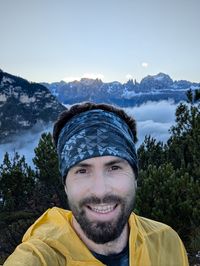
In this post, I’ll take you back to a late-September weekend when Daysi was invited to hang out with her friends at the in . It was supposed to be a girls’ trip, and the rifugio was fully booked anyway, so I had to entertain myself on my own.
Hike Overview: Rifugio Bergamo (Grasleitenhütte) from Lavina Bianca (Tires)
This is a moderate out-and-back hike from the Lavina Bianca trailhead near Tires, following the river up Valle di Ciamin before a steeper finish to .
The good boyfriend I am, I offered to drive the group to Tires. is about 30 minutes east of Bolzano, up in the mountains. And Bolzano is about 50 minutes north on the A22 from Trento. Not too bad of a drive, especially if you’re used to a casual eight-hour hauls for just a quick weekend trip in the US when you’re trying to escape the vast cornfields.
We set off from Trento in the morning. First, we picked up Daysi’s friends in Bolzano, and then we all continued to Tires. As we climbed up the narrow mountain road, it was clear that it wasn’t going to be a sunny day. A thick fog sat in the valleys, and there was no escape no matter how high we climbed.
Trailhead & Parking: Lavina Bianca
Daysi had her residency permit appointment that morning (info post coming up eventually) and it took a bit longer than expected so we only arrived in Tires shortly before 1 p.m. We parked at the free . And shortly after, the girls were on their way to the .
The Route: Valle di Ciamin + Trail 3 / 3A Split
Sitting in the car, I was trying to decide what I would do. 1 p.m. was too late to start anything big, but at the same time the sun wouldn’t set before six and I didn’t want to just drive back home. A decision was made. I was going to explore the area and see how far I could make it before sunset.
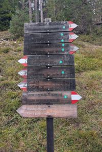
After a thorough inspection of the local hiking signpost, I decided to follow the hiking trail toward , which sits on the west slopes of the Catinaccio Group. It was supposed to take a little over three hours to get there, and I assumed the return trip wouldn’t take me longer than two hours. I should be back before sunset. Perfect. Just to be safe, I decided that by 3:30 p.m. I would turn around and head back no matter how far I made it.
The weather wasn’t getting any better, so I layered up, locked the car, and set off along the hiking trail no. 3. There’s a hut, , right by the bridge crossing the river shortly after the parking lot, but since it was already late, I decided I wasn’t going to stop there this time.
Hike to Rifugio Bergamo (Grasleitenhütte) GPX
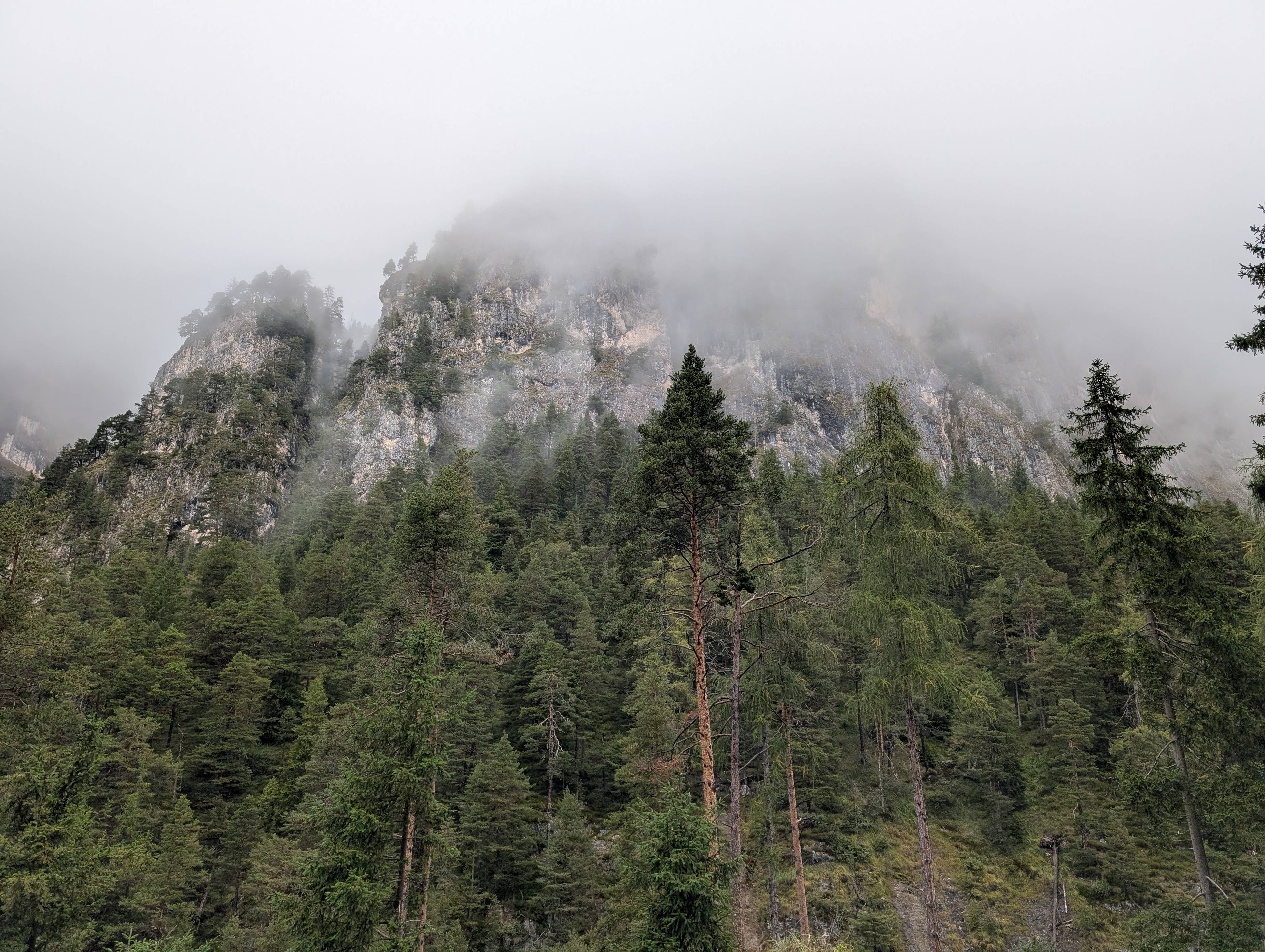
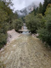
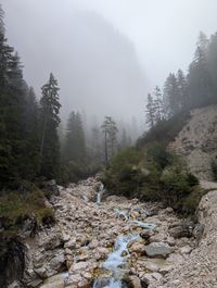
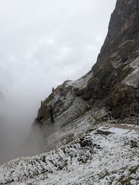
The trail quickly gains about 200 meters of elevation as you enter the valley, but after 30 minutes or so it levels out and begins to follow the river on a mellow incline. At that point you’re deep in the canyon, with cliffs towering on one side and views of the Catinaccio Group on the other. Supposedly that is. I saw none of that, because the thick fog was still arching over my head.
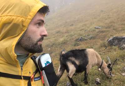
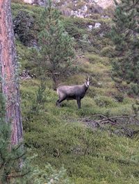
Wildlife on the Trail: Goats in the Mist
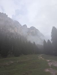
Summer hiking is amazing, but gloomy-weather hikes deserve some love too. At least in my opinion. Yes, it’s cold and miserable, and you probably don’t get the views. But you also don’t run into many other people and everything feels calm and mysterious, You have to keep moving forward for the fog to reveal what was hidden just a few steps back. Sometimes it’s the woods, the cliffs, or a mountain goat!
The trail follows the river for about an hour before it turns left and starts climbing up the side of the valley. 30 minutes later you arrive at another . There, you can either continue on trail 3, which goes up to and , or you can take trail 3A, which goes via up to . If you hike through Passo Principe and continue south, you’ll end up at . We did one of our trad multi-pitch climbs there.
My original plan was to at least make it to this signpost. Depending on the time and on how I felt, I’d decide whether to turn back or keep going. Although I had some idea of my hike, I didn’t really do my homework on the elevation profile. In my head it was mostly flat until the signpost, and I expected a steep hike to the rifugio after
I was wrong. It turns out that by the time you make it to the signpost, you’re already more than two-thirds of the way up. Since it was only 2:30 p.m., and I was feeling good, I decided to continue to .
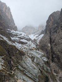
I took trail 3A and started the steep climb. It wasn’t long before I reached 2,000 meters, and to my surprise I saw a light cover of snow everywhere. No wonder most of the rifugios close for the winter already in October.
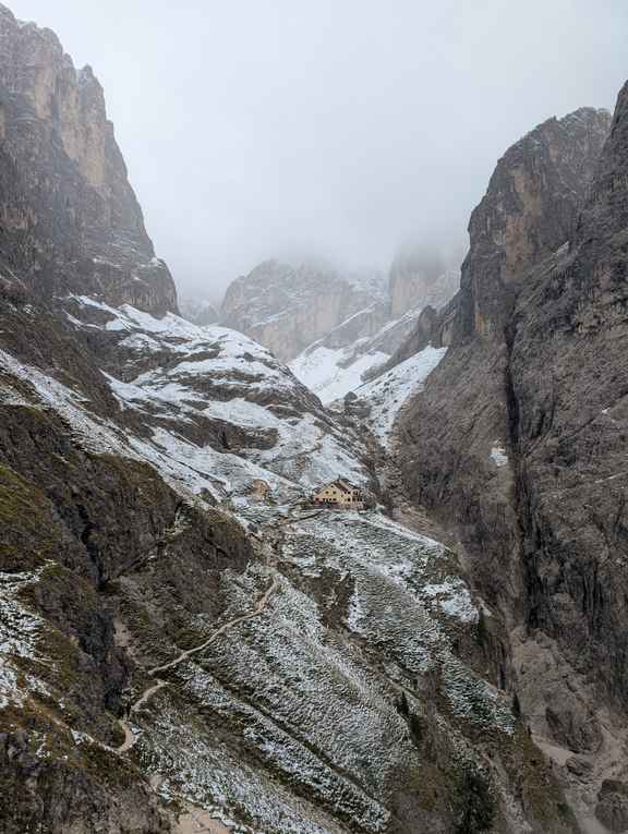
A little farther along the trail, I ran into more mountain goats. A whole pack, actually. These were much tamer than the previous one, clearly used to seeing people. I must be close to the rifugio now, I thought. And I was right. Suddenly the fog cleared a little, and I could see the hut sitting at the back of the valley. A thin ribbon of smoke coming out of its chimney. Warm. I was excited.
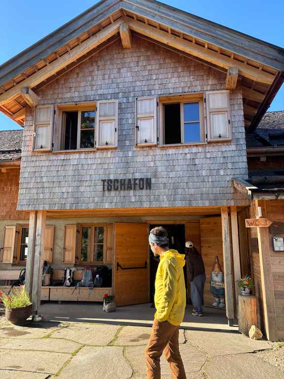
Arrival at Rifugio Bergamo (Grasleitenhütte): Food, Warmth, and Atmosphere
I arrived at the rifugio at 3:15 p.m. 1 hour and 35 minutes of hiking and just shy of 1,000 meters of elevation gain from the parking lot. I walked in and saw a bunch of packs and boots. That’s a good sign. I made my way into a large wood-panelled dining hall with a giant tiled stove in the middle. So warm and cozy. There was a couple sitting at one table playing a board game, and a group of Germans at another table with a couple of large brewskis in their hands. I liked what I saw.

What I didn’t see, though, was anyone who could give me a nice beer and my well-deserved espresso. The Germans noticed my confusion and told me, “Hansl should be somewhere in the kitchen, just yell loud enough.” I tried English, German, and Italian just to be sure, but there was no answer. I had at least 30 minutes to spend at the hut, so I just camped at the bar waiting.
Hansl did show up eventually, but it wasn’t the jolly innkeeper I imagined. I could see he was worried. Instead of asking for a beer, I asked if everything was alright. Apparently, there was an older man at the hut who was not feeling well and they were worried it was heart related. He was stable for the time being, but they decided to radio in for the helicopter. A somber reminder that when something happens in the mountains, you’re not just a quick ambulance ride away from the nearest hospital.
I eventually got my beer and coffee and managed to warm up and dry off a little. As I was paying, Hansl said, “It’s schnapps weather outside. You want some schnapps?” Knowing what was waiting for me outside, I didn’t hesitate, and I had a glass in my hand a second after. Funny enough, it was the same pine-cone liquor Daysi was about to drink at Sesselschwaige the following day. They do really love their pinecone concoctions in the South Tyrol.
Return Hike: Descent Back to Lavina Bianca
I finished my schnapps, slapped a ten-euro bill on the counter, and was on my way, feeling warm inside. It was still cold, damp, and gloomy outside, so the warmth lasted for about ten seconds.
I took the same trail back through the valley to my car. Shortly after I left the hut, I heard the helicopter cutting through the fog. I hope you’re okay, random old dude. The rest of the return hike went much faster (as it always does), both in actual time and in how it felt. Fueled by the schnapps, I was back at the car a few minutes after five.
At the car, I changed into my spare clothes and dry shoes - one of the most overlooked hiking hacks - and I headed back to Trento. Two days later, on Sunday, I came back to pick up Daysi from her refugio retreat. I learnt that it in fact can be sunny in Tires and when it it, the views are stunning.
is so far at the top of my list of rifugios we’ve visited while exploring the Dolomites, and I’ll definitely be back. I want to see the views on a clear day, and I also want to hike there in the winter on snow.
As always, if you want to chat or need help planning a hike in the area, feel free to shoot us an email or DM us on Instagram.